Prelude
Recognising clouds
Before the physics, the eye: learning the faces of the clouds the way you learn the faces of a village.
The essentials in two minutes
- Three keys name the ten cloud genera: the level (the prefix cirro- for high, alto- for middle, nothing for low), the shape (heaps or pebbles: unstable air; sheets or veils: stable air) and rain (nimbo-, -nimbus).
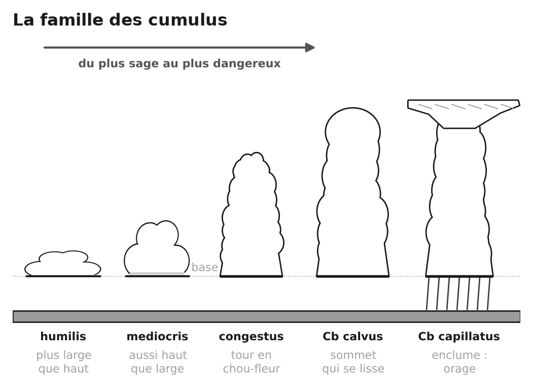
- Cumulus is the visible part of a thermal: its flat base marks the condensation level, and its shape measures the day’s energy, from humilis to cumulonimbus.
- A fair-weather cumulus lives 15 to 30 minutes: aim for the one being born (sharp outlines, dark base), not the one that looks beautiful.
- A congestus before midday, an altocumulus castellanus in the morning: thunderstorms are likely, so fly and walk early.
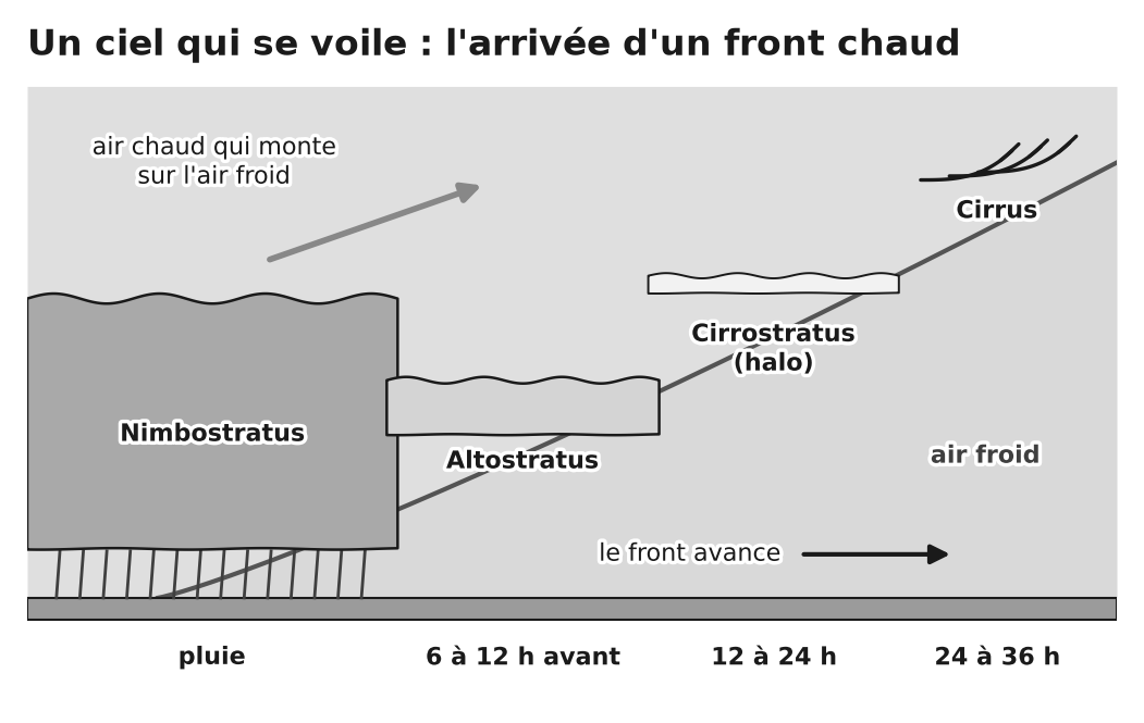
- Ice clouds are not dangerous, but they give warning: cirrus spreading in from the west, a halo, then altostratus — rain within 24 to 36 h.
- Lenticulars, cap cloud, banner cloud: strong wind at altitude, waves and rotors; no flying, even if launch is calm.
- A sea of clouds (under an inversion: you get out of it from above) and hill fog (on the windward slope: you get out of it by crossing to the other side) have nothing in common.
- What matters is not the cloud but how it changes: look at the sky every half hour.
Quiz: 12 questions