Chapter 4
Air masses and fronts
The fighters, the air masses, and the line where they clash, the front.
The essentials in two minutes
- An air mass keeps the memory of its origin (polar or tropical, maritime or continental); heated from below, it becomes unstable; cooled from below, it becomes stable.
- Post-frontal polar maritime air is flying air: cold aloft, heated below, dry, crystal clear.
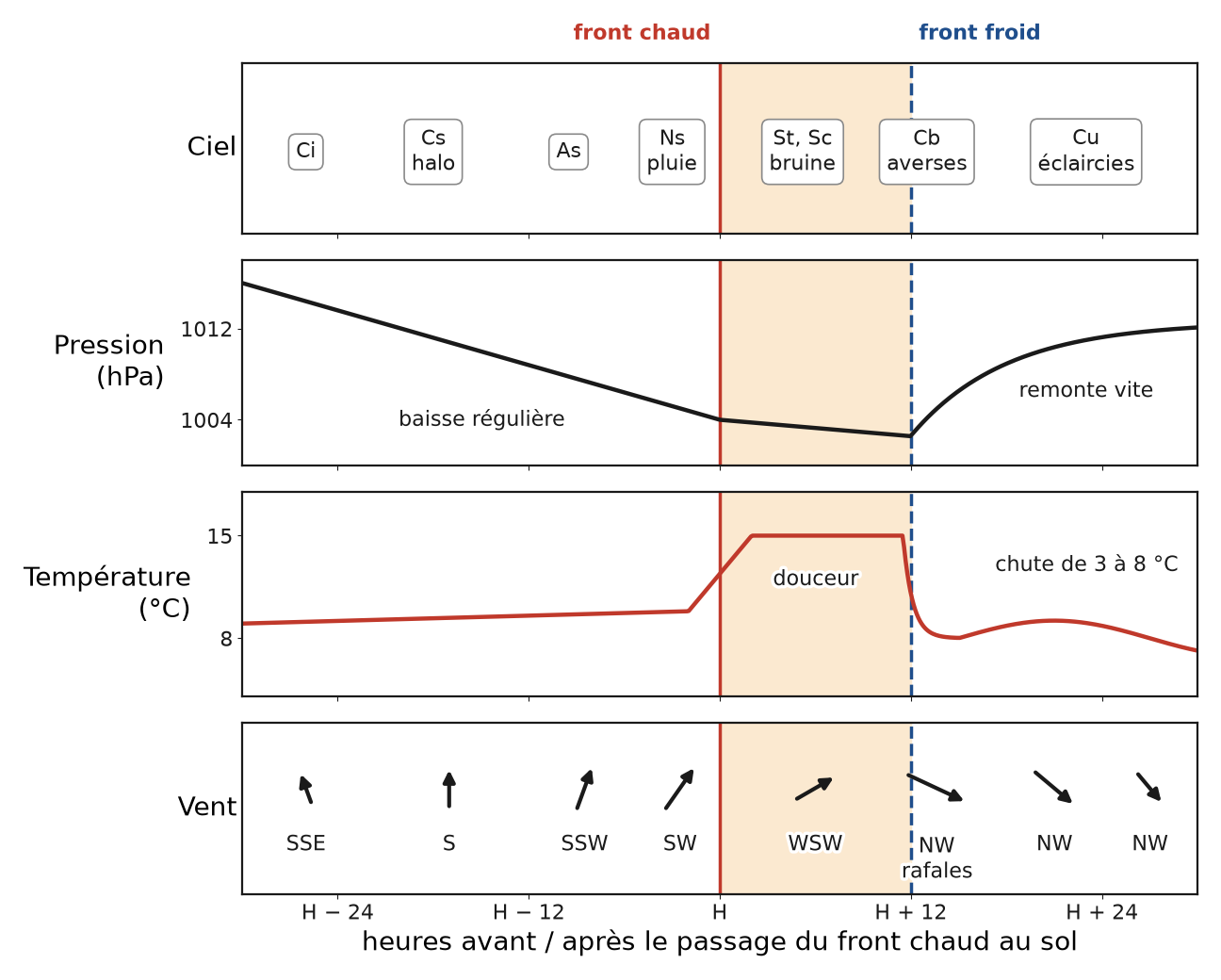
- Warm front: a gentle ramp (1/100 to 1/300), layered clouds, light and lasting rain, announced 24 to 36 h ahead by cirrus, then by the halo (12 to 24 h).
- Cold front: a steep wedge, cumulonimbus, gusts, violent showers, little warning; you must be on the ground an hour before the line, because the gust front runs ahead of it.
- As it passes, the wind veers (S, SW, W, NW), the pressure falls then rises quickly, the temperature rises then drops by 3 to 8 °C.
- An occlusion is the sign of an ageing frontal system: lasting rain, little post-frontal air.
- Before the front, barrier effect south of the Alps and foehn to the north; after it, barrier effect to the north-west, and the southern French Alps sheltered but windy; the best flying slot is the dry post-frontal air, the day after the cold front.
- For hiking: stratiform rain (6 to 24 h), postpone; convective rain (10 to 45 min per shower), work around the windows.